Two Days in Sfakia
There are places in Crete where the road itself seems to announce that you are entering different country, and the approach to Anopoli is one of them. From the coast the road climbs relentlessly into Sfakia, twisting upwards through country that becomes progressively barer and more severe until, eventually, the village appears on its plateau beneath the southern mass of the White Mountains.
I had come here before, but this time there were four of us. We had brought the E-MTBs for three days in the mountains. The intention was simple enough: stay for two nights in Anopoli, ride on the first two days and, weather permitting, ride again on the third before returning home. The weather would eventually decide otherwise, but not before giving us two very different days in some of the finest mountain country I have ridden in Crete.
Anopoli is an obvious base for this sort of exploration. It lies high above the Libyan Sea, separated from the coast by the great southern escarpment and backed by the White Mountains. Roads and tracks leave the village in several directions, but once away from the houses they rapidly become something else: old routes between settlements, shepherds’ tracks, rough mountain roads and lines disappearing into country where limestone determines almost everything.
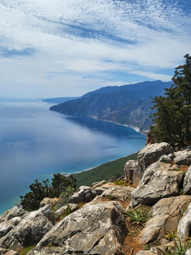
That relationship between people and terrain is one of the reasons I keep returning to these mountains. I can study a map beforehand, plot a route on Komoot and know the distance, gradient and elevation profile, but the map cannot tell me what the ground will actually be like. In Sfakia particularly, the difference between the line on the map and the country beneath the wheels can be considerable.
Day One — Aradena and Agios Ioannis
Our first ride was 37.4 kilometres with approximately 920 metres of ascent. From Anopoli we headed west towards Aradena, crossing the great gorge by the bridge before continuing towards Agios Ioannis and then turning into the mountains.
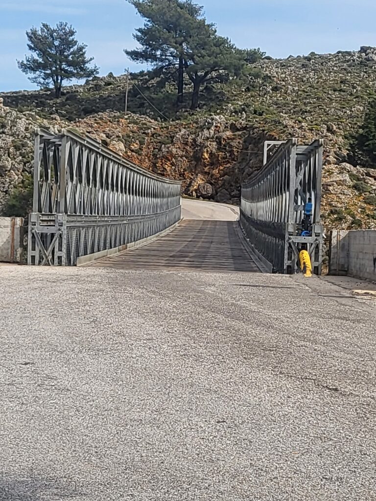
Aradena is difficult simply to pass through. The gorge cuts so abruptly through the plateau that even when you know it is there, its scale arrests you. The modern bridge carries the road across what would otherwise be a formidable barrier, while the abandoned village nearby belongs to an older landscape in which communities were connected by paths and tracks rather than the roads we now take for granted.
From there the route carried us farther into the high country. The surface changed repeatedly: compacted mountain road gave way to loose limestone, embedded rock and sections where the easiest line was not necessarily the obvious one. Pine appeared where the ground and altitude allowed it, sometimes in substantial stands, before thinning again as we climbed towards the higher limestone country.
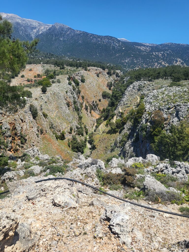
This is one of the pleasures of riding here. The landscape does not reveal itself all at once. A track may run for a while through trees with the mountains almost hidden, then turn around a shoulder and suddenly open onto an enormous view: ridges folding away towards the sea, ravines cutting through the limestone and, above everything, the pale summits of the White Mountains.
The E-MTB makes it possible to travel considerable distances through this country, but it does not remove the mountain from the equation. Loose stone still moves beneath the tyres, gradients still have to be ridden, lines still have to be chosen and a mistake on a remote track remains a mistake on a remote track. Assistance changes what is possible; it does not change the ground.
That distinction matters in Sfakia.
For centuries the mountains have determined how people moved here. Villages that appear close together on a map could be separated by a gorge, a ridge or hours of difficult travel. Shepherds moved livestock through country that demanded intimate knowledge of water, shelter and seasonal grazing. Tracks crossed the mountains long before motor roads appeared, and some of the routes still visible today belong to that older geography.
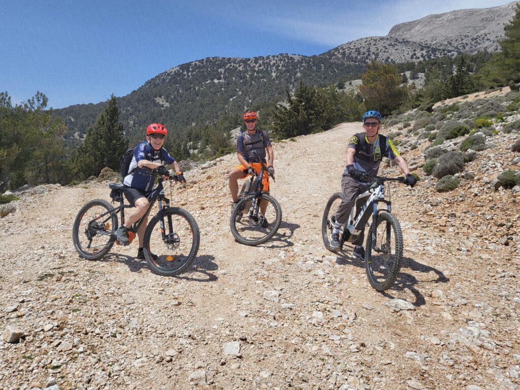
It is impossible to spend much time in these mountains without beginning to understand why Sfakia developed as it did. Isolation is only part of the explanation, but it matters. The mountains provided refuge, observation and routes known intimately by local people but much less readily understood by outsiders. They also produced communities accustomed to relying upon themselves.
Those characteristics repeatedly appear in the history of the region.
Anopoli and Revolt
Anopoli is inseparable from the name of Ioannis Vlachos, better known as Daskalogiannis, the wealthy shipowner and leader associated with the Cretan uprising of 1770. His story belongs particularly to Sfakia, and his monument stands in the village square.
The revolt he helped lead against Ottoman rule ended disastrously. Sfakia was invaded and devastated, and Daskalogiannis eventually surrendered. In 1771 he was executed at Heraklion, traditionally described as having been flayed alive. The episode entered Cretan historical memory not because it succeeded—it plainly did not—but because it became part of a much longer history of resistance to Ottoman authority.
That history did not end with him. During the nineteenth century Crete experienced repeated uprisings, including the major revolution beginning in 1866 and renewed revolutionary activity in 1878. In Sfakia these events were not distant political movements discussed in the towns; men from the mountain communities participated directly in them.
We were to encounter a very personal reminder of that when we returned to Anopoli.
For the moment, however, there were bikes to ride and a mountain to cross.
The route eventually turned us back towards the village. After hours among limestone, pine and high ridges, the return to Anopoli felt almost abrupt. The scattered signs of cultivation increased, walls and buildings reappeared, and the mountain road gradually surrendered to the village.
We had another, considerably higher, ride planned for the following morning.
Day Two — Into the White Mountains
The second day began differently. Rather than spending battery and legs climbing from Anopoli, we arranged for a local farmer to take us and the bikes into the mountains in his vehicle. It was an entirely practical arrangement and one that gave us access to a much higher starting point, somewhere around 1,550 metres.
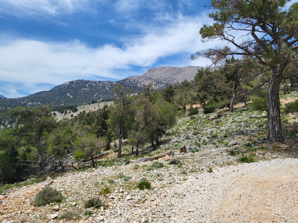
From there we rode upwards.
Our objective was to reach approximately 1,900 metres before turning and beginning what I had particularly come to ride: a long off-road descent through the White Mountains and back towards Anopoli.
The country above the tree line is different again. Vegetation becomes sparse and the limestone increasingly dominant until the landscape is reduced almost to rock, mountain plants and sky. Tracks that appear broad and benign from a distance reveal themselves under the tyres as loose stone, broken rock and channels cut by water. There are few of the normal visual references of lower country, and distance becomes difficult to judge against the scale of the mountains.
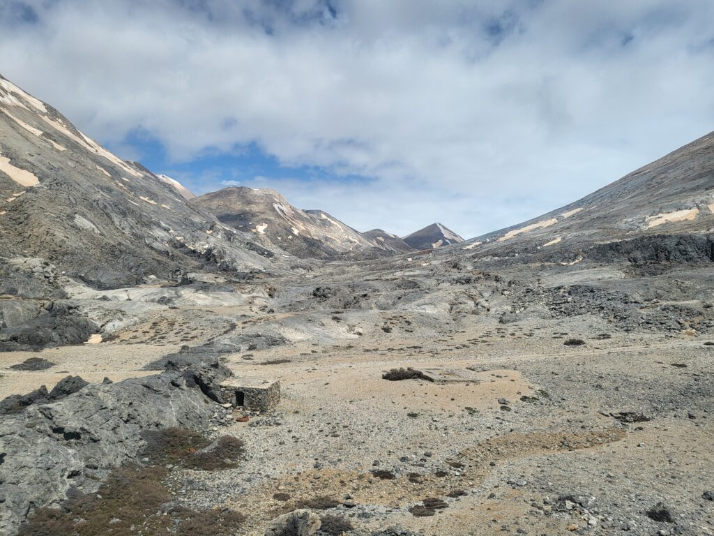
Pachnes rises to 2,453 metres, the highest summit in the White Mountains, and the great upland around it is not a single mountain landscape but an extensive complex of summits, depressions, ridges and high plateaux. From below it can appear as a continuous pale wall. Once inside it, the scale becomes much clearer.
The climbing on this second ride was relatively modest in numerical terms—361 metres—but that figure says little about where those metres occurred. By the time we reached approximately 1,900 metres we were in genuine high mountain country.
Then came the descent.
Over the course of the ride we covered 24.6 kilometres, almost entirely off-road, losing 1,313 metres in elevation. I had wanted a long mountain descent rather than a short technical trail, and this was exactly that: mile after mile of changing surface, open mountain road, loose limestone, broken sections and sweeping tracks dropping gradually out of the high country.
There is a temptation on a long descent to think of it simply in terms of speed, but that would miss most of what makes such a ride interesting. The pleasure is in reading the surface ahead, allowing the bike to move beneath you, choosing the firmest line where one exists and constantly adjusting to what the mountain puts in front of the wheel. On loose limestone the surface can change within metres, and a line that looks clean from a distance may dissolve into fist-sized stone as you reach it.
We stopped from time to time, partly to regroup and partly because it would have been absurd not to look around.
Below us lay folds of mountain and forest; farther out, where the terrain opened sufficiently, was the blue of the Libyan Sea. Behind us stood the pale upper country from which we had descended. The photographs from the ride show something of its scale, but photographs flatten mountains. What they cannot reproduce is the sense of space or the awareness that the track beneath the wheels is only one thin line through an enormous piece of country.
It was while riding through terrain like this that another part of Sfakia’s history becomes easier to comprehend.
May 1941 — The Road South
At the end of May 1941 thousands of British, Australian and New Zealand troops were moving south across Crete after the German airborne invasion had broken the Allied position in the north. With Maleme lost and the military situation deteriorating, the surviving forces were ordered towards the south coast for evacuation by the Royal Navy.
On a wartime map the movement can be reduced to arrows and place names. On the ground it was anything but simple.The principal withdrawal towards Hora Sfakion crossed the White Mountains through difficult country. Men who had already fought for days moved south carrying what equipment they still possessed, often exhausted, short of food and water and under the continuing threat of German air attack. Roads could take them only so far. Tracks, mountain paths and local knowledge became increasingly important as the columns approached the southern coast.
Between 28 May and 1 June the Royal Navy carried out evacuation operations from the Sfakia area, despite the danger from German aircraft. Around 16,000 Allied troops were evacuated from Crete overall, principally from Sfakia and Heraklion, while thousands of others were left behind and became prisoners of war.
Some did not surrender.
Men disappeared into the mountains, individually and in small groups. Cretan villagers, shepherds and resistance networks concealed Allied servicemen, moved them between hiding places and eventually helped some escape from the island. Caves, isolated houses, shepherds’ shelters and mountain settlements became part of a clandestine geography that would continue throughout the occupation.
Riding here gives no special claim to understanding what those men endured. We have modern bikes, GPS navigation, proper clothing, food, water and the knowledge that at the end of the day there will be a shower and a meal. But travelling across the ground does allow one assumption to be discarded very quickly: that a short distance on the map necessarily means a short journey.
In these mountains, terrain governs movement.
The Hidden War
After the evacuation, the same geography that had complicated the Allied withdrawal became useful to those who remained behind.
The mountains of Crete provided concealment but never safety. Allied personnel who had missed evacuation depended upon Cretan families who accepted enormous risks by feeding, sheltering and moving them. Later, British agents operating with the resistance relied upon many of the same characteristics of the landscape: isolated settlements, caves, mitata, shepherds’ routes and people whose knowledge of the mountains could not be reproduced by studying a map.
Patrick Leigh Fermor, W. Stanley Moss and George Psychoundakis are among the best-known names associated with that clandestine world, but concentrating solely upon the famous figures can distort what made the system function. Behind operations lay guides, runners, shepherds, families, priests, villagers and resistance fighters, many of whose names are now far less familiar.
The landscape itself was part of the network.
A shepherd could know which spring still held water late in the year, which track could be followed without entering a village, where a man could disappear for a night and which ridge provided a view of an approaching road. Such knowledge was accumulated over generations rather than acquired during a few weeks of military training.
From the saddle, the logic is readily apparent. A track disappears behind a ridge and a rider can vanish from sight within minutes. Forest breaks up observation. Ravines channel movement. Bare ground exposes it. A route that seems unnecessarily indirect may be the only sensible way around a gorge.
The map tells you where you are. The ground tells you what is possible.
By the time we descended towards Anopoli, the high limestone had given way once more to trees, scrub, walls and the first signs of cultivation. After 1,313 metres of descent the village represented something very practical: the end of the day’s riding, food, a shower and somewhere to sit.
It also produced one of the most memorable historical encounters of the trip.
A Photograph on the Wall
We stayed at Anopoli Rooms, close to the centre of the village. The rooms were clean, the showers hot and the food superb, which after a day in the mountains was about all four of us required.
During a conversation with the owner about Sfakia and its history, he told me that his grandfather had fought in the Cretan revolutions. Hanging on the wall was his photograph.
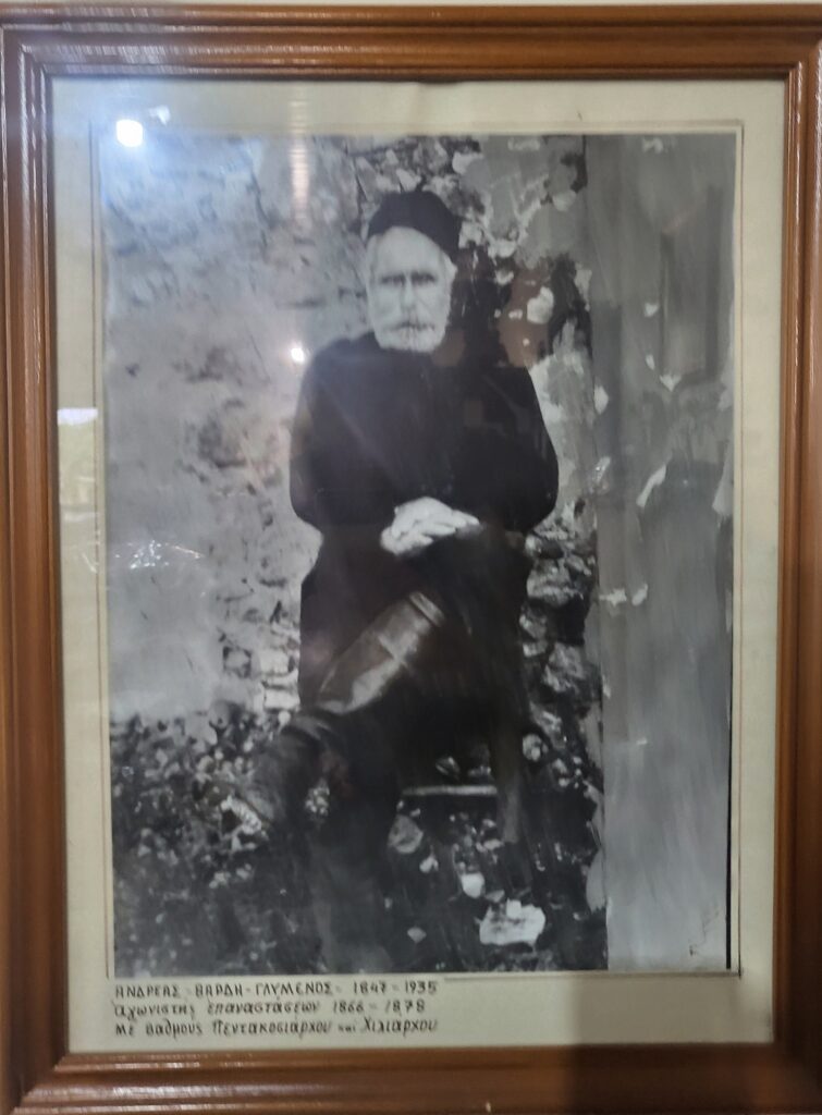
The inscription beneath it identified him as Andreas Vardi-Glymenos, 1847–1935, and recorded him as a fighter in the revolutionary struggles of 1866–1878, with the ranks of Pentakosiarchos and Chiliarchos. Those titles should not simply be equated with modern British Army ranks; they belonged to the revolutionary military organisation of the period and literally denote commanders associated with bodies of five hundred and one thousand men.
What interested me more than the titles, however, was the manner in which the story had emerged. We had not gone looking for a museum or an historical display. We had come down from the mountains, washed, eaten and begun talking. Somewhere in that ordinary conversation about Sfakia, the nineteenth century had quietly entered the room.
The man looking out from the photograph was not an historical personality selected by a curator to illustrate the Cretan revolutions. He was the grandfather of the man with whom I was talking, and his photograph remained on the wall of the family establishment in Anopoli.
That is something I have encountered repeatedly in Crete, and particularly in the mountain villages. History survives not only in monuments and archives but within families, in photographs, stories, names and memories handed down through generations. The documentary historian must still distinguish carefully between family tradition and independently verifiable evidence, but that does not diminish the importance of the encounter. Quite the opposite: it tells us how historical experience continues to be remembered by the communities in which it occurred.
The Third Morning
We had intended to ride again on the third day, but during the night the weather changed. Rain in these mountains alters more than the comfort of a ride. Limestone becomes slippery, loose surfaces change, water begins to use the tracks as drainage channels and conditions at altitude can deteriorate rapidly.
There was little point forcing a third ride merely because one had been planned. We had already had two excellent days in the mountains, and the third belonged to the weather.
So the bikes remained unridden.
Looking back, the cancelled ride did nothing to diminish the trip. If anything, the two days had given us exactly the contrast I had hoped for. The first had taken us west through Aradena and Agios Ioannis and then upwards into the mountains, a 37.4-kilometre circuit with about 920 metres of climbing. The second had begun high in the White Mountains and given us 24.6 kilometres almost entirely off-road, including the long descent I had wanted to ride: 361 metres of ascent against 1,313 metres of descent.
Yet those figures are only the skeleton of the journey.
What remains is the changing ground beneath the wheels: the pine forest giving way to bare limestone, the tracks disappearing around mountain shoulders, the sudden sight of the Libyan Sea far below, four riders stopped on a pale mountain road beneath the White Mountains, and the long descent back towards a village whose history reaches far beyond anything that can be contained in a route description.
There is also the old photograph on the wall
Daskalogiannis belongs to the eighteenth century; Andreas Vardi-Glymenos to the revolutionary struggles of the nineteenth; the Allied soldiers crossing the mountains and the Cretans who helped them belong to the war of the twentieth. They are separate histories and should remain so, but all occupy the same physical landscape. The tracks have changed, roads have been driven through the mountains and bridges now cross obstacles that once demanded long detours, yet the fundamental geography remains.
Perhaps that is why I continue to ride these routes. I can read about Sfakia at home, study the wartime maps and follow the historical record, but eventually I want to see the ground. On a map the White Mountains are contours, spot heights, tracks and names. On a bicycle they become gradients, loose limestone, forest, ravines, distance, exposure and the continual business of deciding where the next wheel should go.
Then you return to Anopoli, sit down to eat and begin a conversation with the man who owns the place.
And occasionally, hanging quietly on the wall beside you, is the next part of the story.