High Ground, Resistance and Revolution Above Asi Gonia
Some rides are measured by distance. Others are remembered because of the ground they cross. This is one of those rides.
Beginning above Myriokefala, the route climbs into the high country between Kollitauros and Kryoneritis, remaining entirely off-road through one of the most isolated landscapes in western Crete. Between approximately 800 and 1,200 metres, the route follows shepherd roads, mountain tracks and narrow ridge paths across open limestone country before returning through a series of stepped descents overlooking Asi Gonia and the eastern White Mountains.
The ride covered 14.4 kilometres with 500 metres of ascent and 500 metres of descent, following a rolling high-mountain loop containing four distinct climbs linked by ridge sections and a stepped return descent. Moving time was 1:07:09, with 38:19 spent ascending and 28:50 descending. Gradients reached +31.0% on the steepest sections and –22.2% on the way down. Maximum speed was 30.3 km/h, with an average moving speed of 12.1 km/h. The route was 100% off-road, across compact limestone track, loose gravel, embedded rock, rain-cut ruts and sections affected by debris and minor landslides.
Each climb was followed by a brief recovery before the next sustained effort began. The longest climb was 2.2 kilometres at an average of 6.2%, while the final climb covered 1.3 kilometres at 6.7%. Those averages conceal the character of the ground. Short ramps reached considerably steeper gradients and required careful line choice, controlled power delivery and constant traction management simply to maintain forward movement.
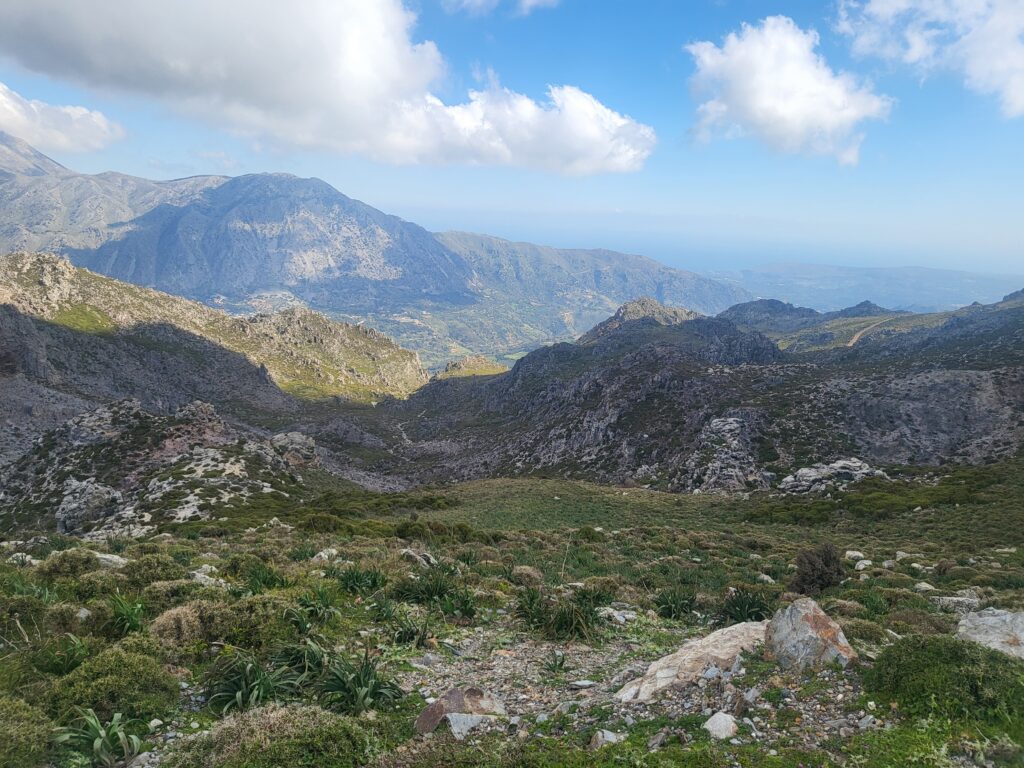
The descents demanded equal concentration. Loose rock, broken edges and irregular surfaces removed any opportunity for passive riding. Braking had to remain controlled and deliberate, with continual adjustment of speed and line.
There were few sections where the surface could simply be trusted.
Riding the High Country
The route leaves cultivated land surprisingly quickly. Olive groves disappear, replaced by open limestone slopes, scattered boulders and low mountain scrub shaped by grazing. The further the climb continues, the more obvious it becomes that this is shepherd country rather than agricultural land.
The track constantly changes character. One moment it crosses a broad basin where the gradient eases and the surface briefly becomes more predictable; the next it climbs abruptly towards exposed ground where fractured limestone and loose stone demand complete attention.
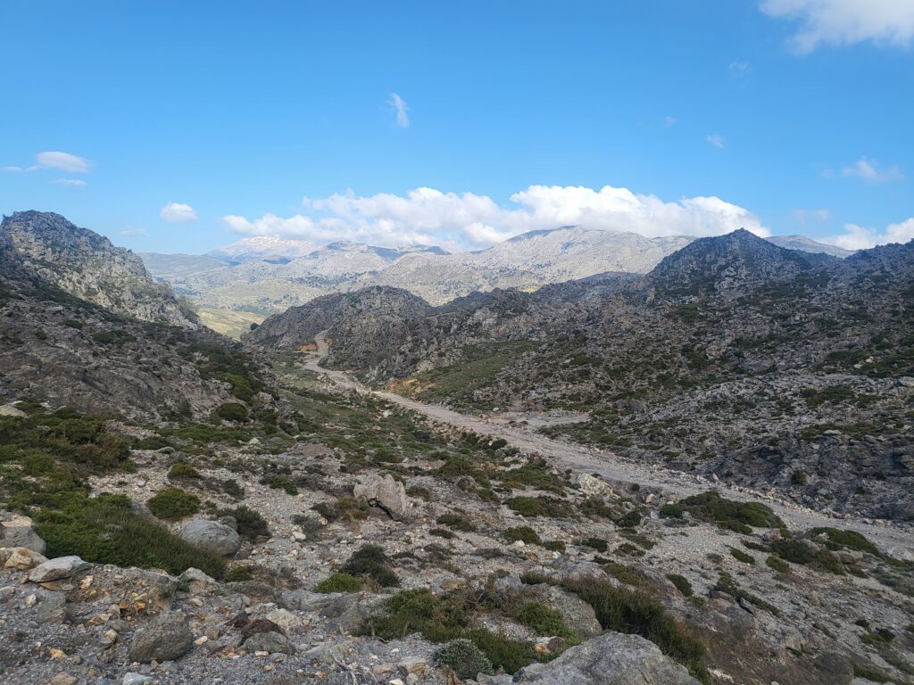
The higher sections open extensive views across western Crete. To the south the ground falls towards the Sfakia hinterland and the Libyan Sea. To the east, the higher summits of the Lefka Ori dominate the skyline.
Despite the scale of the landscape, there is remarkably little modern development. Shepherd roads cross the hills and small plateaus before disappearing around the next ridge. These tracks exist because people needed to move livestock, supplies and themselves through the high country. Riding them gives a practical sense of how upland communities remained connected long before modern roads reached many of these places.
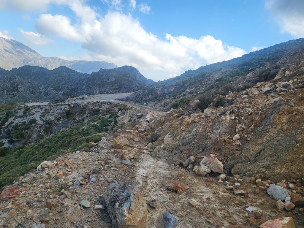
The landscape also shows the forces that continue to alter those routes. Winter rain cuts drainage channels through the tracks, loose material is moved downhill, and fresh debris appears where slopes have failed. A route that was straightforward on one visit may be very different on the next.
The mountain is not a fixed riding surface.
Asi Gonia During the German Occupation
From the higher ground, Asi Gonia lies within a landscape that helps explain its repeated importance during periods of conflict.
During the German occupation, the village and its surrounding uplands became an important centre of resistance activity. The Municipality of Apokoronas records that Vourvoure, in the Asi Gonia area, became the seat of the Supreme Committee of the Struggle of Crete under Colonel Andreas Papadakis. It also identifies Giorgis Psychoundakis as one of the village figures distinguished for his service to the Resistance.
The surrounding mountain tracks offered alternative lines of movement through country that was difficult to observe and control continuously. That does not mean that every path visible today can be assigned a documented wartime function. It does mean that the broader terrain provided the conditions in which clandestine movement could take place.
George Psychoundakis represents that connection particularly well.
Born in Asi Gonia in 1920, he worked as a shepherd before the war and developed an intimate knowledge of the mountain country around the village. During the occupation he became a runner for the resistance and later for the British Special Operations Executive, carrying messages across Crete and supporting British missions operating with the Cretan resistance. His own account became The Cretan Runner.
The Municipality of Apokoronas describes him as a resistance messenger who covered great distances carrying communications between Allied command in Egypt and guerrilla groups in Crete.
That role is easier to appreciate from the ground than from a map.
Distances that appear modest on paper become something entirely different when they involve repeated ascent, broken limestone, exposed ridges, hidden valleys and routes that cannot be followed casually. Psychoundakis’s achievement depended not simply on endurance, but on accumulated knowledge: where a track led, where it disappeared, which line crossed a ridge, where water could be found and how one area of mountain country connected with another.
The same ground that slows a modern rider could provide an advantage to somebody who knew it better than the occupying force trying to control it.
Asi Gonia and the Nineteenth-Century Revolutions
The importance of Asi Gonia as a centre of resistance did not begin in the twentieth century.
In August 1866, during the great Cretan uprising against Ottoman rule, the Pan-Cretan Revolutionary Assembly met at Asi Gonia. In February 1867, the village became the seat of the Provisional Government of Crete. The revolutionary government remained associated with the area until the final stages of the revolt in 1868.
Nearly thirty years later, Asi Gonia again became important during the revolutionary movement of the 1890s. In October 1895 it became the seat of the Metapoliteftiki Committee, which, with local support, repeatedly resisted Ottoman gendarmerie and troops operating in the area.
The geographical logic is clear.
Asi Gonia lies within mountain country connected to Apokoronas, Sfakia and the eastern approaches to the White Mountains. High ridges, narrow valleys and old routes provide several possible lines of movement rather than a single easily controlled approach.
That does not make the terrain impregnable, nor does terrain alone explain resistance. It does, however, affect what is possible. Mountain communities able to move through this country had options unavailable to forces dependent upon the principal roads and more predictable lines of communication.
The village therefore entered the twentieth century with an established history of organised resistance and political activity in the Cretan struggle against Ottoman authority. The circumstances of the German occupation were entirely different, but the landscape in which resistance operated remained recognisable.
The Ground and the History
This ride offers considerably more than difficult mountain biking.
It crosses a landscape where geology, weather, route knowledge and human movement have repeatedly interacted. The steep limestone ridges, concealed basins and isolated uplands that challenge a rider today were also the ground through which shepherds, revolutionaries, resistance fighters and wartime couriers had to move.
The comparison needs care. Riding an E-MTB through these mountains is not equivalent to travelling through them during revolt or occupation. The purpose, risks and consequences are entirely different.
But the physical ground can still be examined.
A gradient remains a gradient. Loose limestone still affects movement. A ridge still controls what can be seen from either side. A valley may still provide concealment from ground observation. A route that connects two areas today may preserve a line of movement that long predates the modern road network.
The physical effort of riding this country makes those facts difficult to ignore.
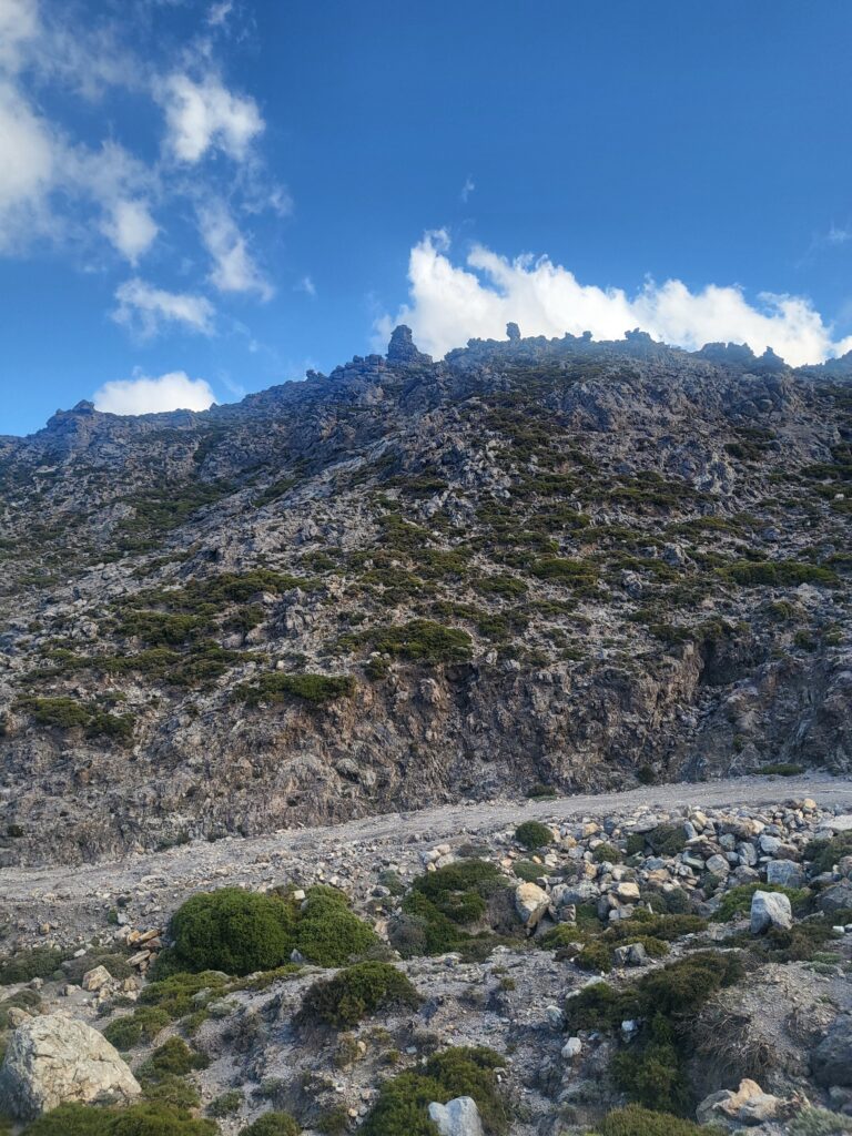
Every climb and descent reinforces the same point: movement through mountain terrain is constrained by the ground, and knowledge of that ground changes what is possible.
That is what links the ride to the history below it.
The landscape is not simply where these events happened.
It helped determine how people could move, where they could gather, what they could avoid and how resistance could continue.
Closing
The tracks across Kollitauros and Kryoneritis belong to a landscape in which movement, isolation and memory remain closely connected. The revolutionaries, shepherds, resistance fighters and couriers who crossed this country did so for very different reasons, but all were constrained by the same ground. Riding it today does not reproduce their experience, nor should it be presented as doing so. What it can provide is a direct understanding of the terrain: the distances, gradients, broken surfaces, concealed approaches and mountain routes that shaped what was possible. That is why returning to the ground remains an important part of understanding the history attached to it.
Herodotus expressed the purpose of recording the past at the very beginning of the Histories: that human achievements should not be erased by time, and that great deeds should not become “without glory.”
Herodotus, Histories, I.1
More than two thousand years later, that remains reason enough to follow the old tracks, examine the ground, and record what happened there.